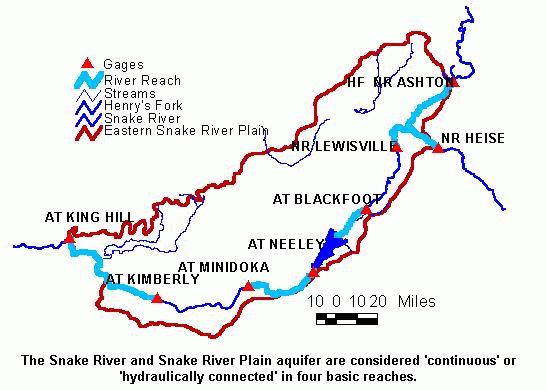
Labels:text | map | font | diagram OCR: Gages River Reach HF NR ASH TOT Streams Henry's Fork Snake River Eastern Snake River Plain NR LEWISVILLE NR HEISE AT BLACKFOOT AT KING HILL AT NEELEY AT KIMBERLY AT MINIDOKA 10 0 10 20 Miles The Snake River and Snake River Plain aquifer are considered 'continuous' or 'hydraulically connected' in four basic reaches.